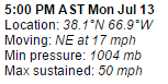
TS Claudette as Good as She Gets... NE Dancing out to Sea

There's Claudette racing NE.
She looks like a semi naked Follies dancer
with her head dress off to one side

You get the idea.
She has a name, but she is not a well formed storm!
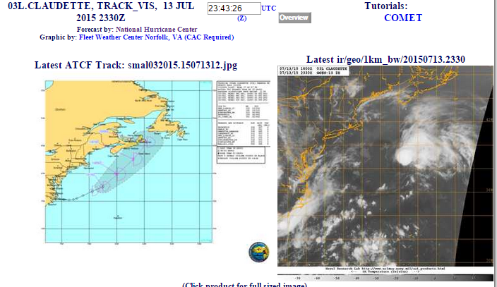
According to the NHC Discussion at 5 PM this is basically as good as it gets for Claudette! She is currently sheared with the strongest convection to the NE of her center. Vertical wind shear will increase and keep her in check and as she moves further into the North Atlantic. The lower water temperatures further North will also hold her in check. She could have a burst or two of convection before she eventually becomes a tropical depression approaching the Maritimes. Models are in obvious agreement with Claudette's current strength being short lived. This is within what we call "Climo" in that it's common for a storm to pull together off the Carolinas, wrap up, intensify in forward speed and shoot NE out to sea flirting with the Canadian Maritimes.
The Canadian Hurricane Centre is on it!

So for now we simply enjoy the beauty of an unexpected Tropical Storm....
....spinning in the Atlantic...

We could see another system like this form and become Danny.
Keep watching...
Stay tuned....
She is for now.... doing her thing....
"That you are here—that life exists, and identity;
That the powerful play goes on, and you will contribute a verse.”
Besos Bobbi
posted by BobbiStorm @ 5:08 PM
![]()


0 Comments:
Post a Comment
<< Home