2 Dead in Havana. Coastal Low Hasn't Even Formed and there's Tropical Problems
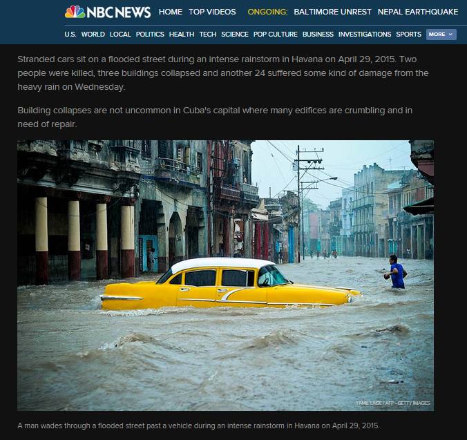
Havana flooded . . .
A month before the Hurricane Season...
....caught between a cold front & a flow of tropical moisture!
http://www.ssd.noaa.gov/goes/east/carb/wv-animated.gif

This set up is a problem now and later.
Thoughts?
I have many thoughts. In North Carolina today the sky looked like a summer afternoon with storms forming, it felt like winter...... cold and damp.
There is a low pressure system on top of this area, swirling around a bit. The rain was coming out of the north, cold... not very May like... more like fall actually, oddly.

Highlighting the messy over NC & VA.
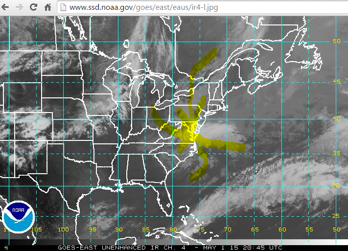
Picture below is current, the one above is from today at 5 PM. Tomorrow you will be able to compare and contrast the two. Note the front down by Florida that stretches all the way to Cuba and Cuba in fact had flooding rains today.

Havana underwater

2 people have been killed. Read the story below.
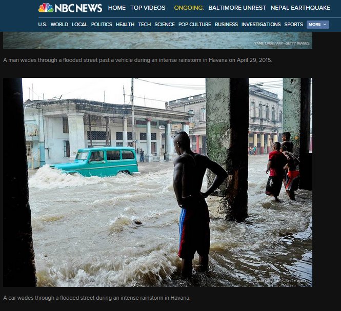
Makes for a dramatic picture, but a lot of misery.
http://www.nbcnews.com/news/world/heavy-rains-slam-havana-n351741
As for the models everyone are talking about and the possible "subtropical" system next week.
It's really too soon to tell. The EURO has been screaming early development for the last week and the GFS jumped on board with a somewhat different end game today. Between now and Monday the models will vary and we will be able to see in real time what will be as we get closer to "next week" so anything I say here is just discussion as in "shooting the breeze" vs a hard forecast.

There is a front......... very far South for this time of year. I do believe this problem of fronts moving across the country and dipping down WILL be a problem for at least the early part of the pre-season as well as May which is it seems "pre-season" ... and that's a problem. It's easy for any system to spin up at the end of either side of a dangling front meaning the GOM and off the coast of Florida.

Next let's discuss water temperatures. I put a red line across the map showing where there is energy to support a more tropical system. Those temperatures change a bit, but they have been consistently HOT and note how red and orange they are along the SW and SE coast of South Florida and the Bahamas.
North of there the water and conditions favor a "subtropical" or the always dreaded "hybrid" storm. These storms transition faster than Bruce Jenner so the situation bears watching. What's in a named really? Does it matter if a storm is named Pat or Patricia? Does it matter if it's name is simply BOB or BOBBI and really why has their never been a BOBBI on the name list I wonder?
Seriously look at the pictures from Havana... a storm by any name or without a name can and will cause misery, death and destruction. The message boards are filled with discussion every year on tropical disturbances that merit a "special tropical statement" yet not a name that cause landslides and flooding in Hispaniola and Puerto Rico.
The system next week may form down near the Florida coast, but it will move up along the coast towards the Outer Banks paralleling the coastline... as storms often do.
Short term discussion is shown below from the NWS in Wilmington, NC.

Long term discussion which is more mentioning long range possibilities for the same area is below.
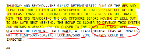
Bottom Line is the Carolina Coast is in for a blustery few days with high surf and possible beach erosion. Any real Outer Banker will tell you that's just a normal for that neck of the woods that sticks it's head far out into the Atlantic where storms riding the Gulf Stream ANY time of year affect the region. Unless it has a name and is at least a Cat 2 it don't impress them much...
We are really splitting hairs right now as the models are not that different. The main difference for now is on the timing on the formation of this "meandering system" and how close it is to the actual coastline.
Levi Cowan's game book shows both possible set ups.
Euro:

GFS:

That pretty much sums it up for now.
Note I used the forecast for North Carolina, but that applies to places like Myrtle Beach in South Carolina and the Upper Outer Banks in Virginia or near the NC/VA line. We can talk on any effect this could have on the Mid Atlantic, but for now we are still wondering where and when it will form.

Note TWC is in full Tropical Update Center at Hurricane Central. Yes Virginia the hurricane season could start early as often happens.
www.flhurricane.com has yet to discuss the system that may form. That system may in fact have a name, it's name may be COASTAL LOW ;) but we are all watching.
I'll be back Saturday evening to update this blog if the situation warrants. Trust me it's been fun for people like me to watch the loops, see models and well.. it's like watching the NFL Draft, it almost feels like the football season is here. It's not, but let me be happy a bit enjoying the illusion.
Sweet Tropical Dreams,
Bobbi
posted by BobbiStorm @ 3:24 PM
![]()


0 Comments:
Post a Comment
<< Home