2013 Winter ----> 2013 Hurricane Season. Will the Beat Go On?
So any good tropical weather person will immediately look at the snow totals in New England, coming on the tails of Hurricane Sandy...2 back to back "historic events" and immediately wonder... "how will this translate to the coming hurricane season?" It's just the way our mind is wired.
Historic Hurricane at the very end of the 2012 Hurricane Season followed by a wet, early season snow fall ...followed by a "historic" blizzard and we immediately start doing historical research on the Winter of 1938 and 1939...followed of course by the severe winter of 1940.
All the talk going into this last hurricane season was about the developing El Nino that never did quite materialize in time to make a big difference during most of the season. The jury is still out on that. As everyone argues Global Warming and what to do about it and if it in fact is happening the way they say it is... El Nino and his sister La Nina seem to have gotten lost in the shuffle. About as missing in action as the Los Angeles Serial Killer who may or may not be up in the mountains or down in Mexico.
1938 going into 1939 was an El Nino Episode.

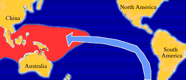
Much like the Everglades... it is a RIVER that runs through the atmosphere...deep down into the ocean currents and travels for miles across the ocean. The warmth or lack of warmth in the water effects the atmosphere up above (much as they say as above so below) it's all related... the sister sun and brother moon.
So...there is this great illustration of how the way of the world works... atmospherically and oceanographically speaking. Wonder how this affects the geologists of the world but they are a rock of another color. Snakes slither around rocks...they got to be careful. It's a whole other ball game.
Moving illustration:
See the problem is that the year prior the El Nino of 1939 - 1940 was a La Nina Event.
Does that mean it was a TRANSITION year between La Nina and El Nina when the 38 Hurricane hit New England? I guess... and as we know all transitions are difficult.

Hurricane Andrew came in August... the A storm as we were transitioning...
Hurricane Sandy came as we were supposed to be going into El Nino (but didn't) and then the days after Sandy saw a snow storm on top of a hurricane. The pattern for hits on New England from storms that form around the Outer Banks and slam into New England the Long Island seems still set in stone...or what looks like stone so for the short term that trend should continue.
Then what? What's next? And....how will this correlate to the 2013 Atlantic Hurricane Season is my question and should be the question on the mind of every tropical weather person out there.
People are discussing it. Quietly in the background. No one seems to be able to get a real feel as last year's predictions sort of bombed out.
Are we "neutral" meaning both sister and brother are off somewhere conjuring up possible trouble down the road or... just neither is in charge?

Good chart from a good blog.
http://www.liveweatherblogs.com/index.phpoption=com_community&view=
groups&task=viewdiscussion&groupid=8&topicid=2639&Itemid=179
Basically September is currently a crap shoot... anything goes?
The final word usually goes to the Government authorities:
| DIAGNOSTIC DISCUSSION |
| issued by CLIMATE PREDICTION CENTER/NCEP and the International Research Institute for Climate and Society |
| 7 February 2013 |
ENSO Alert System Status: Not Active
|
Synopsis: ENSO-neutral is favored through Northern Hemisphere spring 2013.
During January 2013, ENSO-neutral continued, although below-average sea surface temperatures (SST) prevailed across the eastern half of the equatorial Pacific (Fig. 1). While remaining below average, a high degree of variability in the weekly Niño 3 and 3.4 indices was apparent during the month (Fig. 2). The oceanic heat content (average temperature in the upper 300m of the ocean) was also below-average (Fig. 3), largely reflecting negative subsurface temperature anomalies in the eastern Pacific. At the same time, positive anomalies increased and expanded eastward to the central Pacific by late January (Fig. 4). The variability in both the ocean and atmosphere was enhanced during January, at least partially due to a strong Madden-Julian Oscillation (MJO). Consequently, the location of the MJO was reflected in the monthly averages of wind and convection. Anomalous upper-level winds were westerly over the eastern half of the equatorial Pacific, while low-level winds were near average. Relative to December 2012, the region of enhanced convection shifted eastward and became more prominent over Indonesia and the western equatorial Pacific (Fig. 5). Despite these transient features contributing to cool conditions, the collective atmospheric and oceanic system reflects ENSO-neutral.
|
1939 was not a busy season... then again we were not naming sub-tropicals and extra-tropicals then either.

Compare that to the famous 1938 Season:

It's an interesting thing to think on... then again life is complicated and today is the first day in weeks none of my kids are traveling or about to travel so am going to enjoy it. Someone is always in transit in my world... sort of like planets... always moving around.
Interesting day in that the Pope is stepping down for health reasons and you don't see that every day.
When we argue weather we are discussing weather events since 1850... give or take when good record keeping began... history of snow storms doesn't go back far before the 1700s... America as we know it didn't go back before the 1770s... yet the last time a Pope "stepped down" was the 1400s...now that is historic!
More later...
Besos Bobbi
Ps... Yes wild video of yesterday's twister on www.weather.com and Orko is terrorizing the Plains and as much as I want to stand on the beach in Miami under a plam tree and feel the balmy breeze, go all hog wild taking pics of tropical delights and hanging with my best friends Sharon and Malka... am gonna be sort of annoyed if I miss a snow storm... such decisions ...not easy for a messy meteorlogical muse.
Enjoy the article below that was published in the Miami's Community Newspapers.
http://www.levimeyer.com/22666/dsp_agent_page.php/191976
That's my son... buy a house from him or list a house by him... he is a third generation Miamian dealing in Real Estate... no one knows Miami better than that! Am proud of him.. always have been .. always will.. life around Levi is always a thrill ;) (test to see if it reads this). I've written a lot of things, been published a lot of places and written with some pretty famous people ... but this collaboration was the best thing I've done in ages :)
http://www.communitynewspapers.com/archive/south-miami/

Links for history and weather... by the way... it really is COLD up north and when you really want a condo or a home away from home where the sun shines in February... Henry Flagler had it right... you have to go all the way to Miami to find a place where the freeze doesn't hit ya..
http://en.wikipedia.org/wiki/1938_New_England_hurricane
http://thehistorytavern.blogspot.com/2010/12/worst-snowstorms-in-history.html
posted by BobbiStorm @ 8:24 AM
![]()


0 Comments:
Post a Comment
<< Home