Waves to Watch
According to The Weather Channel there is nothing out there to disturb the weather in the Tropics tonight.
That's a good rewrite of the NHC's "FOR THE NORTH ATLANTIC...CARIBBEAN SEA AND THE GULF OF MEXICO...TROPICAL CYCLONE FORMATION IS NOT EXPECTED DURING THE NEXT 48 HOURS.
FORECASTER AVILA" but it doesn't quite tell the whole story.
The story is unraveling in bits and pieces like a winter knit scarf that is shredded at the edges and piece by piece of the yarn begins to become undone.
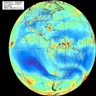
Tropical weather doesn't just happen suddenly over night. It evolves in an ever changing patchwork of clouds and rain and wind flow and jet streams and upper level lows and changes in the patterns and patterns that create the drama that will become the 2008 Hurricane Season.
A wave that didn't crash into South America but mostly lifted up into the NW Caribbean and made its way into the Caribbean mixing with moisture from South America flowing north is now still alive and kicking up midnight rain showers in Cuba. See the radar though it might be gone or moved on by morning.
http://www.met.inf.cu/asp/genesis.asp?TB0=PLANTILLAS&TB1=RADAR&TB2=..
/Radar/01Casablanca/csbMAXw01a.gif
And, showers are moving north through the Straits of Florida towards the Florida Keys. Showers are popping up everywhere caught up in a strong flow out of the South.
Maybe a part of this wave will make it's way into the Gulf of Mexico or simply rain itself out over the Everglades or move off of the Florida coast into the Bahamas.
Don't know. Can't say. It's an ever changing tapestry of a meteorological masterpiece.
And we watch the waves as they move across the beautiful planet we call Planet Earth.
One of my favorite sites... hit animate and watch the moisture ooze around the planet.
http://www.nrlmry.navy.mil/sat-bin/display10?PHOT=yes&AREA=global/atlantic&PROD=vapor&NAV
=global&CGI=global.cgi&ARCHIVE=Latest&MOSAIC_SCALE=15&CURRENT=LATEST.jpg

Is that so beautiful?
What Steve Lyons means on the Tropical Update is there are no named, official storms or areas about to be named. There are no advisories. There are no warnings or watches. But there is most definitely weather my friend. Somewhere, someone tonight is sitting on a beach or near the sea wall in Havana or maybe in a boat and is having one heck of a thunderstorm as there is a bright orange dot hovering and doing the Cha Cha on the radar.
Tomorrow I will get rained on or someone will get stuck in severe thunderstorms agitated by the passing tropical wave.
Across the ocean in the Atlantic is an African Wave that is struggling to survive as it makes its way across an unfriendly ocean that is climatologically not ready for the most excellent waves that are moving off of Africa too early in the season.
What we need to watch is the waves ...
We need to watch the patterns that are becoming set this June as we move into July and it is not too early this year for a Cape Verde Storm to form. Unless something big changes, some TUTT out in the Atlantic causing a break in the high or some upper level lows reminiscent of last year or cooler than normal water temps suddenly cooling off the already warm water the waves that form will follow this little wave over Cuba's track and follow the high all the way to Florida or Texas or maybe skim the Gulf stream and slide through the Bahamas just off shore like Floyd did..
Watch the Waves... watch and see if any somehow develop but more so watch the unfolding pattern that will tell the story for this years Atlantic Hurricane Season coming to a theater near you... and then suddenly Steve Lyons will look agitated and excited and on top of the story explaining how the Bermuda High is in place and a rotation has been found on satellite imagery and a hurricane hunter found a west wind and the NHC has decided to issue advisories on Bertha or Cristobal or Dolly and the cone will show parts of the South East coastline in it's path and we may get lucky and we may not.
But that's the way things work in the Tropics. We watch the Waves as the full moon rises over Miami and Havana and we feel the moist, humid air hanging heavy over our Tropical Cities.
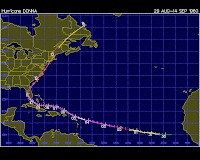
May not happen in 2008 nor did it happen in 2007 but it did in 1960 when Hurricane Donna formed from a Classic Cape Verde Wave and it will happen again, this year, next year or in ten years but history does repeat itself when it comes to Climatology!

Sweet dreams, sleep tight and know that somewhere, some weather person working to provide a forecast for your area is watching a wave tonight.
Besos Bobbi
ps.. anyone ever notice how much Steve Lyons looks like Avila?? Did I just type that :) Nite..


0 Comments:
Post a Comment
<< Home