Something To Think On.. Re: Noel West Bound
Okay... first with regard to the Front
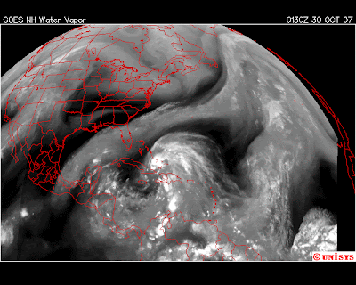
here is the wv from 12 hours ago.. with your hand, cover the storm and only look at the top part so as not to be distracted.. just look at the front

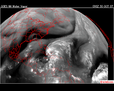
Now look at the newer WV image which was current around 10am Tuesday

Note the front has gone somewhat Flat and if anything is the high pressure is moving out over the storm shoving Noel to the west not the NW... not saying wnw may hopefully happen but for the moment that front is not moving SOUTH and the front is moving more from west to east.. out waiting for some impulse to sweep it more to the SE and until that happens...
Noel is a name Miamian's will come to associate with one of those flakey Halloween Storms.. hard to forecast and a big Question Mark for tomorrow..
Waiting on the 11am.. will post more later after that comes out
For now.. understand that a few models of reliable fame do take this storm closer to Florida and the Keys than the CONE is showing.
One..takes it through the Keys (mid Keys) and cuts NORTH and then cuts up along the inland suburban corridor like some Miami-Dade/Broward commuter driving home from work...then out WPB into the Atlantic.
IF it was my call I'd err on safety and post a Tropical Storm Watch or Warning... and remind people we don't expect it to be Andrew but we might have strong enough winds to have power outtages and you might want to stay home from work tomorrow AND keep the kids in.. cause this isn't about a pressure gradient, it's about a Tropical Storm called NOEL.
be back later.. Bobbi


0 Comments:
Post a Comment
<< Home